|
WELCOME—Thanks
for dropping by! |
|
|
Archive
Project News and Notes |
|
|
|
My, how the time
has flown. Can it really be 18 years since we put this site up on the
web? After
a couple of years of building, we started keeping track of the site
statistics in mid-2002. Since then, more than 1.6 million visits (over 350 a day) have shown that we
are not the only ones who find the hidden history of this continent
fascinating. During that time we have developed working deep map
models as the framework, so stories about the families, places
and peoples that have underlain the big picture histories of larger
events could be told. We have also devoted significant attention to the soundtrack
which ran in the background of daily life, and have been privileged to
become friends with some of the artists and authors who sang the songs
and explored the byways of the twentieth and twenty-first centuries.
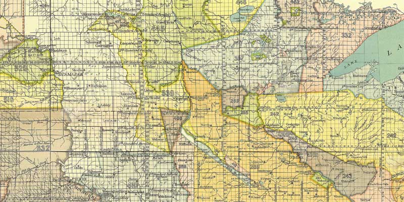 Most
recently, we have launched a long-anticipated project to bring another
layer to the Deep Map, in the form of a graphic index to the history
of land cessions from the Native American tribes to the U.S. In 1900,
a near-1000 page volume was published by the Bureau of Ethnology,
containing 67 state and region maps with transfer tracts indexed to
annotations for the transfers. The cession process didn't end cleanly at state
boundaries, however. For our purposes, we needed a unified map
graphic to serve as the gateway to the annotations. It took a while,
but it has been assembled and has begun to be sliced into panels to
eventually form a nearly 250-screen, coast-to-coast layer within the
Deep Map. The first 15 of these, as shown above, will serve as the
"seed stock" for the remainder. Enter the "Quick
Start" panels from the image above or go directly to the map from
the
"Deep Map" button at left. Now
it's time to expand the stock of stories on the "where and
when" shelves of the information warehouse we have created.
During 2018 we will be exploring new relationships and alliances with
historical organizations, foundations and families, with the goal of
adding substantially to the infrastructure of everyday history here on
the Northern Plains. Keep
coming back to watch it develop. We'll be here. In
the meantime, here are some of the things we've been involved in
during the last few years. |
|
|
From the Department of "You Want To
Use WHAT??"
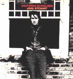
Click picture for the Stewart
Collection
California Bloodlines
was released in 1969
and would become number 36 on Rolling Stone's list of 200 most
important albums of all time. 38 years later it has been treated to
an amazing re-mastering and the track notes are from our Record
Shelf.
Of course, we're a tad bit proud.
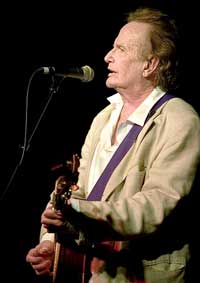
John Stewart, 2007
(Thanks Howard Brauensteiner) |
Excitement at the
record shelves!
(Ok, "excitement" might be a little
strong...)
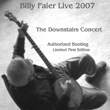
The first
recording from the Archive Project itself, a live performance by
legendary banjo man Billy Faier on the 50th anniversary of his first
solo album, has been issued as a Limited Edition.
and
John Stewart's
classic first solo album has been re-issued with liner notes from the
Archive Project
and We discovered a recording of a live performance by the Gateway
Singers from February, 1957, and it has been released on the Folk Era
label as a double-CD. We also provided some pretty extensive liner
notes.
And it's in stereo. Which ain't too bad for a 1957 bootleg. 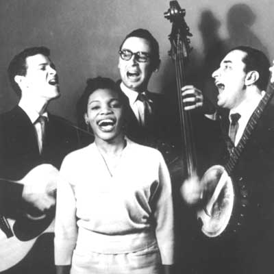
(Travis Edmonson, Elmerlee
Thomas, Lou Gottlieb, Jerry Walters-1957)
Click John's or Billy's picture for
details and ordering
|
"Legends still move among us and giants aren't all 30 feet
tall..."
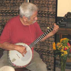
Click picture for the Billy Faier
collection
Billy Faier's first, essential,
album was released in 1957. He was a pivotal figure in American
folk music long before. He visited the Archive Project and gave a
house concert in 2007 and was back just about every spring until he
passed in 2016. He allowed a bootleg recording from the
audience at that first concert. The rest is
his story...
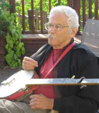
Billy Faier, 2007
(Thanks Angela Henriksen) |
|

|
Work
continues on the Gift Shop Record Shelves essays and
identification of artists and recordings
for
The American Basics Recordings Collection
(Prewar "Blues" and "Folk")
and
The Gift Shop continues to feature
John Stewart & Jack Weatherford
See the entire catalogue of "hard to
find" published work by these two American creative giants. "Get
it all in one place." We have
almost everything they have done. We can help you find the rest.
The Bookshelf continues to offer
the "Medicine Shelf"
with classics about traditional ways, and commentary,
as well as other works about the hidden history of America. |
|
|
Substantial work has been
completed to add more CDs to the Recordings Shelves. Next up will
be more American Basics, including the roots of American
"Folk" music. |
|
|
Elsewhere at the Archive Project |
|
|
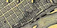
Deep Map News—New: levels 5, 6
and 7 complete the core around the River Flats and downtown Saint
Paul. Click the image to jump straight to level 5 in 1867 (time
windows for the present and 1851 also available) or zoom in from the Deep
Map buttons.
|

Quick Notes—The
Archive Project:
"What's it all about..."
|
|

Reminder---The Towboat Contest can still
be seen on-line in the
Working River section.
|
|
|
|
|
|
|
|
|
"What's It All About?"
(If
you are a return visitor, click here.)
No matter whether we marked the end of the millennium as 2000 or 2001,
many of us seem to have been in a mood for summing up and looking back.
Since the mid-1980's, the Northern Plains Archive Project has been
quietly laying the foundation for a place where we can turn for "the rest of
the story."
The dream began as a home for the common history of the plains,
available at the turning of the millennium and growing after. A place where regular folks could
turn, on their own terms, for the questions of "How did we get here?" and "How
do I fit into all of this?" The stories of the generals, industrialists,
politicians and church leaders are easy enough to find. The archive is an
environment for the tales of the privates and NCO's, carpenters and masons,
beat cops and shopkeepers, farmers and ranchers, the "unofficial" community
leaders, and other people without whom the "official" history could not have
occurred. It is built around a "deep map" that allows us to drill down through
place and time to the stories that didn't necessarily make it into the
books.
Since a lot of the hidden history belongs to those who were here 600
years ago, those who were brought against their will, those whose options were
limited by indenture or language, and those who were either running away from
something or toward something on a personal level, there had to be room for all
races, religions, and nationalities in both the archive and its planning. We
found that if we looked at things from the point of view of the place that has
nourished us all—what the land saw and heard—we could
build on the things we had in common, across all the barriers. And the more we
built, the more we had in common. Interesting.
There was also a consensus about the "building blocks" that had to be
fitted together to hold up such a structure. It had to be open-ended, because
we can never know everything that happened. It couldn't just be on computers,
because some of us have to touch things to feel the past. It had to reflect the
viewpoint of regular folks—cumulative, bottom-up historical
information— because we wanted to be able to draw our own conclusions. It
had to be sounds and pictures and people speaking, because a lot of us learn
more from well-told stories than from books. It had to supplement existing
institutions and organizations, because we're builders and makers and we're
trying to bring something, not take something away. The pieces had to be built
by regular people, because we wanted to leave a legacy of skills—as well
as information— and some of us have to learn how to do things by actually
doing them.
And it had to be inclusive, because those of us who live here are
affected by those who came before.
It's an information environment, a technology hot-house that
has built its
own computers and created its own processes, and a lot more. It has been
described as an informational "quilt frame" to allow the inclusion and
interconnection of "squares" relating to people, families, groups and
organizations who have linked to the land. During 2000,
there was a migration to this space of small portions of about 15 gigabytes of
material that had been developed over more than ten years. During 2001 and
2002, additional
and new material was added, and from 2003 to the present we have driven the deep map down
seven levels along the Mississippi river flats and been exploring the
soundtrack to our hidden history. Now we hope to begin
opening the environment to individuals, families and organizations who wish to
tell their stories within the framework.
The paradigm is different from an encyclopedia model, where you have to
know what you're looking up. This is not going to be "top-down" history.
Instead, the point of view is that of the common folks who did the work, tended
the animals, sent their kids to war and hoped for the best. The interface
doesn't start from "who, what, when, where... ."
Most of us don't think that way, really. To a greater or lesser degree,
most people start with "where." And then "when." And then "what was happening?"
We don't get to "who" until pretty late in the inquiry. And that's all right,
because often the real purpose of our questioning and research is not to write
a paper, but to relate ourselves to events and places, and try to figure out
how in the world this whole thing came to be.
We know that historians have a vital role. Most of us come from cultures
with traditions of oral history and its keepers, whether they were the Winter
Count Society, or the Seanachies, or someone else. But we've found that a lot
of what has been held out as history, and presented as truth, turned out to be
something entirely different with scrutiny over time.
The project doesn't have a political agenda beyond our belief that all
of us are affected to some degree by misinformation. And all these years of
discussions, laughter, plans, coffee-making, sharing and hoping have told us
that the real stuff is more likely to pull us all together, than to divide us
up and push us apart.
Pulling together is what it's all about. And laughter. And sharing.
And hope.
—For
return visitors—
The deep map has now reached seven levels, with at least two time
windows at each level. Most recently we have begun the process of adding an
underlayer to Layer Two, in the form of a visual tract index of the land
transfers that moved the American continent from ownership by the tribes to
cession to the U. S. We are also working on adding to
the demonstration core in the River Flats area of Saint Paul,
Minnesota, to offer an information environment for the decades between 1850 and
1950, and open it to stories of the families that lived on and
around the flats. This work is on-going. We
recommend that you check the "Tell Me More" button to find out
about the most recent revision increments. We are also actively pursuing
grants to support the work on the area around the River Flats and on the
"Treaty Map." Your comments at this time
would be particularly welcome, via E-Mail at questions@hiddenhistory.com.
 Back to the top.


